Rock Formations
Carve Your Vacation Out of Stone
Southwest Wyoming has a high-desert climate that resulted from a playa, or ancient lake. The lake receded and dried up thousands of years ago, leaving behind soil formed by the erosion of sandstone and shale. Although few green things grow willingly in Sweetwater County besides sagebrush and prairie grass, such a setting made conditions ripe for the natural phenomena of stunning rock formations.
Many explorers, topographical engineers and geological enthusiasts have visited Sweetwater County to view the awe-inspiring rock formations, and traveled the east-west route through Sweetwater County, marveling at the formations created by eons of rain and wind. Plan your next trip to Sweetwater County to marvel at some of Mother Nature’s finest work. To help you explore the breathtaking rock formations found throughout the county, we compiled a guide to view six geological wonders in the area.
Castle Rock
What Makes it Special?
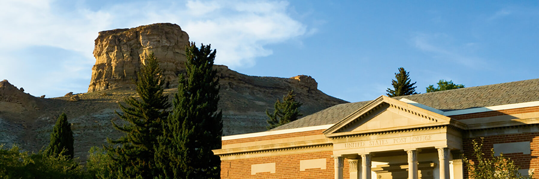
Castle Rock is the most formidable geological landmark in Sweetwater County. Castle Rock overlooks the city of Green River and is located near downtown. This rock formation has been called many different names through the years including Citadel, Indian Head Rock and Green River Butte. Castle Rock consists of horizontal strata, and many of the layers of rock are rich with fossilized fish and plants, a testimony to the vast lake that used to encompass most of the region.
Where is it?
High above the town of Green River along I-80. Castle Rock can also be reached by hiking up the north end of 3rd West Street in Green River.
The Palisades
What Makes it Special?
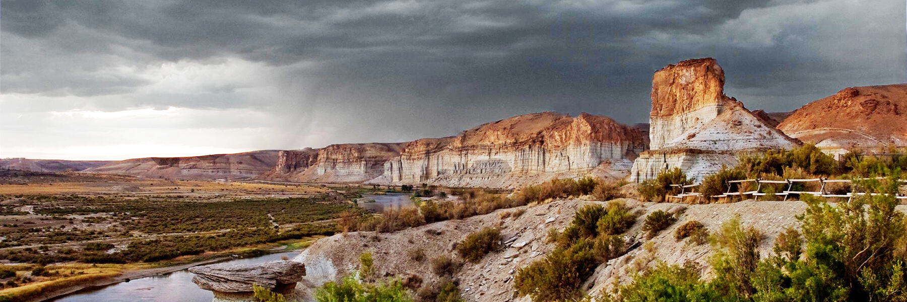
The Palisades rock formation in Sweetwater County is deeply engrained in the history of the county; from Native Americans using the area to cross the Green River during low water and finding excellent protection via the formation from the elements to trappers and traders during the days of the American Fur Company in the early 19th century using the Palisades as a reference point during travel. The Palisades are also a popular subject for painters and photographers, the rock formation was most notably depicted by famous artist Thomas Moran, in his painting “Cliffs of the Green River.”
Where is it?
Located along I-80, west of Green River.
Tollgate Rock
What Makes it Special?
Tollgate Rock was so named because of the number of tolls collected at its location. Stories vary, but one of the most often told tales is that early-day Mormons cut a road through a natural gate on the south side of the rock. A chain was installed and a fee charged to those who wanted to use the road. Sweetwater County records do show that a toll was assessed many times over the years for use of the road or for a ferry on the river. Tollgate Rock climbs to 6,440 feet above sea level, and is a sight not to be missed.
Where is it?
Slightly northwest of Green River along Lincoln Highway.
Pilot Butte
What Makes it Special?
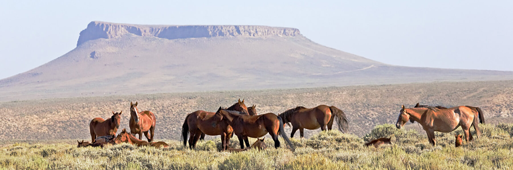
Pilot Butte dominates the surrounding landscape and is the second highest point in the immediate regions, standing at 7,949 feet tall. Due to its size, Pilot Butte, located on top of White Mountain, has been used as a landmark since the first people came to the region. Native Americans used it to find camping and hunting grounds as well as rivers and streams. Today, it is still used by stock men, pilots and hunters to orient themselves in the area. The butte can be hiked, so make sure to wear appropriate footwear. The climb to the summit allows a breathtaking, panoramic view for miles.
Where is it?
Pilot Butte is located directly on top of White Mountain. White Mountain is immediately north of Rock Springs. From Rock Springs, take U.S. Hwy. 191 north for 10.5 miles and turn left at the "Wild Horse Loop" signs (County Road 53) and follow that route across the mountain. There is a road off the "Wild Horse Loop" (County Road 53), follow that road left towards the butte. To see a map of the area, click here.
Take a Virtual Tour of Pilot Butte
Kissing Rocks
What Makes it Special?
Kissing Rocks are suspended in time and space. Depending on the direction of travel, the two rock formations appear to come together in a kiss or pull away from a just-completed kiss. Native Americans believed the spirits of two doomed lovers from opposing tribes inhabited the rocks and would spend eternity just out of each others’ reach. In a modern twist on this ancient myth, rival teams who come to play against Green River teams don’t look at the rocks because legend says that doing so will cause the visitors to lose.
Where is it?
East of Green River along I-80.
Boar’s Tusk
What Makes it Special?
Boar's Tusk, the core of an ancient volcano, rises straight out of the ground and guards the Killpecker Sand Dune field. Standing 400 feet high, it is a striking feature in the middle of the desert and prominent landmark on the Overland Emigrant Trail. Along with Devil's Tower in Northeast Wyoming, it's one of only two such geological features in the state, and this natural attraction is not one to miss. Boar’s Tusk also has great religious importance to Native Americans from the region.
To get to Boar’s Tusk, a four-wheel drive vehicle is recommended. Boar’s Tusk is a popular spot for photographers looking for the perfect snapshot of an iconic attraction. Come see one of Wyoming’s most prominent and exotic geological features.
Where is it?
From Rock Springs, travel north on U.S. 191. Approximately 10 miles north of Rock Springs, turn right at Sweetwater County Road 4-18 (at sign that reads Petroglyphs, Sand Dunes, Boar’s Tusk) and turn left at CR 4-17 (Tri-Territory Road).
Disclaimer: This is a true “off the grid experience” cell service is limited! Make sure you have extra water, and a high-clearance, four-wheel-drive vehicle with thick tires (and a spare tire) to traverse the dirt roads. Let someone know where you are headed and when you plan to return.
Take a Virtual Tour of Boar's Tusk
Honeycomb Buttes
What Makes it Special?
Kaleidoscopic buttes and rugged badlands are a stunning sight to see when you visit the Honeycomb Buttes in Sweetwater County. Located in Wyoming's Northern Red Desert along the rim of the Great Divide Basin, and about 50 miles north of Rock Springs, the Honeycomb Buttes were named for the numerous mud caves found here. The area is great for backcountry recreation including backpacking, horseback riding, wildlife viewing, photography and more. Access to the area requires a four-wheel-drive, high-clearance vehicle and good navigational skills as many of the roads are unnamed.
Where is it?
From Rock Springs, travel north on U.S. 191 toward Farson for about 36 miles. Turn right onto WY-28 E toward Lander. Turn right on County Road 445 before the South Pass Rest Area and follow the road for 11.5 miles. Park along the road, and travel east along a two-track route toward the Honeycomb Buttes wilderness study area. View a map of the Red Desert created by the Wyoming Outdoor Council or contact the BLM Rock Springs Field Office for more information.
Disclaimer: This is a true “off the grid experience” cell service is limited! Make sure you have extra water, and a high-clearance, four-wheel-drive vehicle with thick tires (and a spare tire) to traverse the dirt roads. Let someone know where you are headed and when you plan to return.